Showing posts with label Battlefields. Show all posts

Tuesday, September 11, 2018

Highest Point In Alabama

Cheaha State Park near Pulpit Rock

Soon after Tim and I married, he was transferred to Fort McClellan in Anniston, Alabama, for a six-month stint at the military police academy there.  It was our first introduction to living in the South where the Civil War is still called by some, The War of Northern Aggression.  Somehow in those six months, we never realized that just a short twenty miles away was Cheaha Mountain, the highest point in the state of Alabama.


When plotting our route back to the farm for fall harvest, I googled "top tourist attractions in Alabama" and Cheaha State Park popped up.  Online photos of the park were stunning.


Learning that the park had both a hotel and a restaurant, I quickly made reservations for a three-night stay.


Twice we missed turns as we made our way to the park.  To say that it is off the beaten path is a true assessment.  But it was worth it to finally reach the summit where the vista unrolls for miles and miles.


During our stay we practically had the park to ourselves.  In fact, one evening we dined alone in the restaurant with its floor-to-ceiling windows.  Questioning our young waitress, she told us in her sweet Southern accent that while business was slow now that children are back in school, the park will be flooded with leaf-peepers come fall.  Oh, how I wish we could be here then!


Ever on the prowl for waterfalls, I persuaded Tim to hike to Cheaha Falls with me.  This three-tiered cascade flows over a rock face located three miles into the Talledega Forest.  It's a beautiful place.


Another day we hiked a few miles of the Pinhoti Trail which stretches 171 miles across Alabama (and another 100 miles through the mountains of northern Georgia) before it connects to the Appalachian Trail.  The section we crossed was a narrow tract overgrown with brush, not as well maintained as I'd hoped.  Tim's reconstructed knee was aching by the time we returned to the car.

Pulpit Rock

So I left him behind at the hotel while I made the pilgrimage to Pulpit Rock.  Wow!  The vista seen from that outcropping of rock was amazing.  Well worth the effort, despite the fact that I missed the trail blaze on the way back and had to backtrack for a time to find it.


All of that, however, could not compare with the magnificent sunsets for which we had ringside seats.


On the last day of our stay we drove to Horseshoe Bend National Military Park, the scene of the end of the Creek Indian War.

Chief Menawa

There on March 27, 1814, Tennessee militia under the command of General Andrew Jackson massacred 1,000 Red Stick Creek Indians led by Chief Menawa.


The Creeks hoped the protection of the river bend on the Tallapoosa River and a log barricade across the neck of the peninsula would suffice to save them, but Jackson sent Brigadier General John Coffee and his troop of 700 infantry to surround the bend across the river from where the Creeks were camped.

White posts tell the approximate location of the barricade.

Then Jackson ordered a frontal assault on the wooden barricade.


At the end of the day, at least 800 of Chief Menawa's men were dead.  The peace treaty following the battle added 23 million acres of Creek land to the southeastern United States--roughly three-fifths of  Alabama and one-fifth the state of Georgia.

General Andrew Jackson

For Andrew Jackson, the victory at Horseshoe Bend was the first step on the road to national fame and the White House.

Likewise, Cheaha State Park was our first step on the road back to the farm for fall harvest.  I'm thankful I had a second chance to find this beautiful place.


Thursday, May 17, 2018

Fort Necessity

For three and a half hours through pouring rain, from Washington, D.C., Tim and I fought our way up the Allegheny Mountains, playing leap-frog along the interstate with two oversized vehicles, each carrying half a house, before we reached Confluence, Pennsylvania.


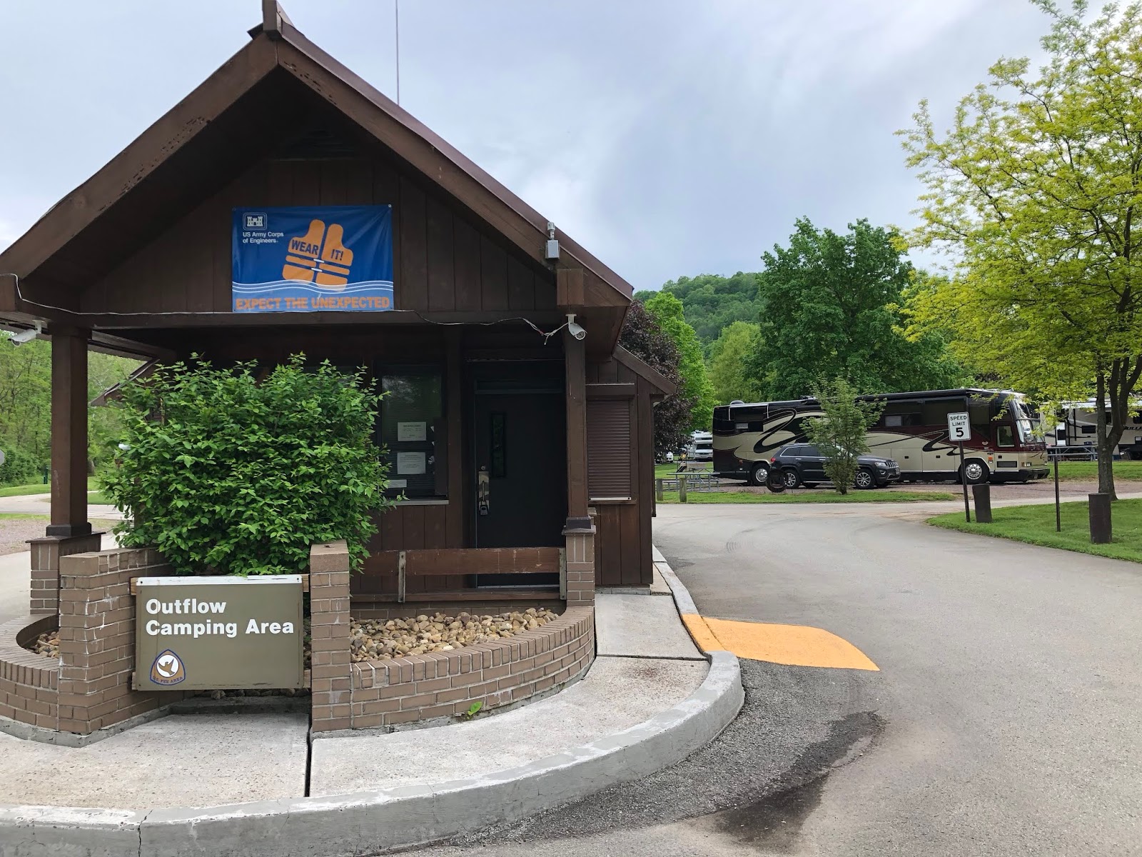
Then the sun broke through the clouds just as we reached the Outflow Corps of Engineers campground, the Dawntreader's newest home for the next four rainy days if the weather forecast holds true.  After we tied the bus to the campground's hook-ups, I wasn't sure I could persuade Tim to drive over to yet another National Park Service battlefield, but given the forecast, I believed that this afternoon might be our only dry chance to see Fort Necessity, scene of one of the opening battles in the French and Indian War.  I pleaded that it was a necessity and Tim, good husband that he is, caved to my request.


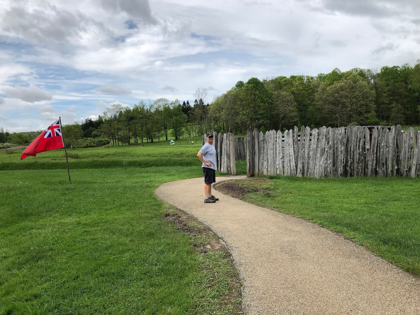
There, in a rare meadow of the frontier forest, British soldiers raised a small, circular stockade in May 1754.  On May 28, 22-year-old Lt. Col. George Washington and 40 militia skirmished with a small French detachment, killing 13 French soldiers and their leader Ensign Coulon de Jumonville, at a nearby place that came to be known as Jumonville Glen.


Now Washington decided to build a "fort of necessity" to defend his 130-man regiment from a large French army he assumed would seek revenge.  While waiting for reinforcements and further orders, Washington kept his men busy with the orders they had been given; that of extending the British military road, the one that would link the French held-Fort Duquesne (present-day Pittsburgh) with the Atlantic seaboard.


Leaving Fort Duquesne, 600 French and 100 Indians paddled up the Monongahela River, then made their way to Fort Necessity to confront Washington and his men.  Vastly outnumbered, Washington had to surrender and accept Captain Louis Coulon de Villiers' terms for peace.


Only the interpreter misread the French document to Washington, leaving out a sentence that claimed Washington assassinated deVilliers' brother at Jumonville Glen.  After listening to the relatively favorable terms, Washington signed the document and thereafter regretted that his reputation had been sullied by doing so.

Upon learning of Washington's defeat, Great Britain sent General Edward Braddock in 1756 to drive the French from the Ohio Valley.  Braddock had no experience with the guerrilla warfare employed by the French and their Indian allies.  Caught off-guard as he advanced towards Fort Duquesne, Braddock and almost 1,000 of his men were killed.


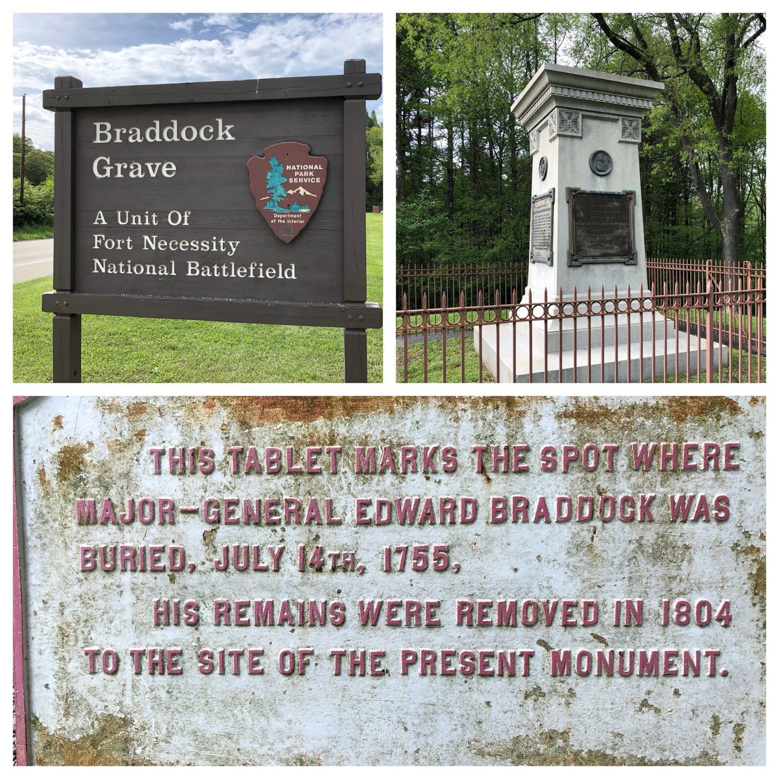
Concerned that Braddock's body would be mutilated by the victorious French and their Indian allies, Washington buried him just a mile from Fort Necessity beneath the military road that came to bear Braddock's name.


Fifteen years after the battle, Washington bought 234 acres surrounding the ill-fated Fort Necessity, "land [that] is valuable on account of its local situation and other properties...it affords an exceeding good stand on Braddock's Road from Fort Cumberland to Pittsburg, bears a fertile soil, [and] possesses a large quantity of natural meadow fit for the scythe."   Washington built a tavern there, hoping that it would prove profitable once Americans began pushing westward.


Today as Tim and I traveled to our campground, we drove along U. S. Route 40, once Braddock Road which became the main thoroughfare from Cumberland, MD to Wheeling, West Virginia, before the interstate highway was constructed less than a dozen miles south during Eisenhower's presidency in the 1950s.  How strange to think that we were following in Washington's footsteps!  How odd to know that General Braddock's body was once buried beneath our road!

Tuesday, May 1, 2018

Petersburg Is the Key


"The key to taking Richmond is Petersburg" believed Civil War Union General Ulysses S. Grant.  Consequently, when his more direct forays against the capitol of the Confederacy failed, Grant swung his soldiers east and then south to lightly-defended Petersburg in a masterful move meant to sever the supply line of the rebel army.  It was arguably the one time Grant outmaneuvered the canny Confederate General Robert E. Lee.

The Eppes Plantation at City Point

On our way to Washington, Tim and I devoted a day to seeing how Grant did this.  Having lived in Virginia for more than fifteen years, we've become Civil War buffs.  Something about seeing the sites where major battles played out has given the war an immediacy that has captured our interests.  However, in all the time we lived here, we never made it to Petersburg, that is until now.  So beware!  The rest of this post is a history lesson of what impressed us the most about the siege.


With its proximity to the confluence of the James and the Appomattox rivers, Petersburg was a transportation hub that funneled what war materiels the South still possessed to Lee's ill-equipped rebel soldiers dug in at Richmond.  By the time of the Siege of Petersburg from June 1864 to April 1865, the freight of all but one railroad from the Deep South bound for the Confederate capitol passed through Petersburg.


When I was a child, one of our family vacations was a trip to Durango, Colorado, where my railroad-mad dad made reservations for us to ride the Durango & Silverton Narrow Gauge Railroad.  That ride  sparked my own interest in railroads and made me pay attention to the importance of the railroads at Petersburg.

To sever those rail lines, Grant laid siege to the city and made use of the dormant City Point section of the South Side rail line to build his own railroad to supply his troops.  This ability to build railroads as needed was another way more industrialized North surpassed the South. The railroads of the Confederacy, in keeping with its strict stance on states' rights, were not centrally controlled like those in the North.  To prevent their purchase by rivals, Southern railroad companies would lay track using different gauges, a business practice that proved detrimental to the Confederate war effort.

Plantation of Dr. Richard Eppes where Gen. Grant established his headquarters.

I found it interesting in our visit to Grant's headquarters at City Point that he chose to live in what looked like a shack instead of appropriating the plantation home of Dr. Richard Eppes for his personal quarters after the Eppes family fled to what they supposed was the safety of Petersburg.

Grant's Headquarters on the grounds of the Eppes' Plantation

So Grant built a short line from the wharfs he quickly constructed at City Point, the base for one of the greatest logistical operations of the Civil War.  There more than 100 ships a day dropped supplies of food, ammunition and supplies which were then ferried by rail to the Union Army entrenched on the east side of Petersburg.


Had the Union commanders pressed their advantage upon their arrival at Petersburg, the siege might not have been necessary, but alas they did not.  At 7 p.m. on June 15, 1864, the boom of Union cannons to the east foreshadowed an attack on the Dimmock Line.  Minutes later, the soldiers of the Union 18th Corps broke through the undermanned Confederates and swarmed over Battery 5, a fortified earthworks emplacement for heavy guns.


In the two hours that followed, the Federals captured 1.5 miles of Petersburg's defenses.  Though few Confederates stood between the Federals and the streets of Petersburg, Union Maj. Get. William F. Smith stopped his advance to await reinforcements.  Had he continued his momentum, nine months of tedious, deadly siege could have been avoided.


"We could blow that damn fort out of existence if we could run a mine shaft under it." ~ A private of the 48th Pennsylvania, June 23, 1864.


Spurred by the offhand suggestion of a former coal miner, Lt. Col. Henry Pleasants put his 48th Pennsylvania to digging.  Their objective was to tunnel under the Confederate line and blow up the battery at Elliott's Salient.

Such a plan stirred Tim's memory of his stint in the Army when he was assigned to the Corps of Engineers, the division that performs a variety of construction or demolition tasks under combat conditions.  Naturally, Tim was fascinated to learn that Pleasants' troops secretly proceeded with their plan literally right underneath the noses of the Confederates.


Beginning on June 25, 1864, and continuing for the next month, these Pennsylvania coal miners burrowed a shaft 511 feet into the hillside.  Then they packed four tons of powder into the magazines under the Confederate battery.  At 3:16 a.m. on July 30, Lt. Col. Pleasants lit the fuse and scrambled out of the tunnel.  After a 30 minute wait for the explosion to detonate, Pleasants concluded that the fuse had gone out.  With dawn approaching and at risk of losing the surprise attack, two volunteers, Lt. Jacob Douty and Sgt. Harry Reese, crawled into the tunnel to try lighting the fuse again.  This time it worked.  Two hundred and seventy-eight Confederates died in the explosion that created a crater measuring 170 feet long, 60 feet wide and 30 feet deep.  Two 1,700-pound cannons were hurled completely out of the works.


But instead of pushing through, the first waves of Union attackers simply stood at the Crater, gawking at the incredible scene they'd created and thus allowed the Confederates to regroup.

And so it went, first one side and then the other surged back and forth, but it was just a question of time.  With the arrival of spring, the beleaguered Confederates and the city fell.  Seventy thousand Americans were casualties at Petersburg.  Infection and disease accounted for the greatest number of deaths.

A window at the Eppes Plantation at City Point
By preserving the Petersburg National Battlefield, the National Park Service gave us a window to look back at this important event.  Two weeks later General Robert E. Lee surrendered at Appomattox Court House and the war ended.


Sunday, April 2, 2017

Woo, Woo, Chattanooga!

Steam Locomotive on display at Terminal Station

When you hear the whistle blowin' eight to the bar
Then you know that Tennessee is not very far
Shovel all the coal in
Gotta keep it rollin'
Woo, woo, Chattanooga there you are.
~ lyrics to Glen Miller's popular song, Chattanooga ChooChoo

Tim and I continued to roll north towards Nashville for a planned weekend with our daughter Jillian.  Yet, woo, woo!  There was Chattanooga, a city we'd driven through before but never had time to explore.  So we pulled our RV, the Dawntreader, off the interstate and camped three nights at Holiday Travel Park of Chattanooga.

Although I majored in history as a college undergraduate, I didn't focus my studies on the Civil War.  However, Tim and I became Civil War buffs when we moved to Virginia back in 1987.  Ever since then, we've tried to visit the war's battlefields; we planned to see three such grounds on this leg of our journey.  Perhaps one day we'll revisit these battles in their proper order by following the victorious path of the Union Army of the Cumberland south towards Atlanta, but that's a future trip.


This time we are heading north.  Our first stop was a brief visit to Kennesaw Mountain National Battlefield.  With our Jeep in tow behind the RV, we were limited in what we could do there.  Instead of touring the battlefield, we had to settle for learning what we could of this significant Union tactical defeat at the park's Visitors Center.

Given the objective to capture Atlanta, the South's major industrial center, General William T. Sherman pressed further into Georgia in the summer of 1864.  He sent this report to Washington: "The whole country is one vast fort, and Johnston must have at least 50 miles of connected trenches...and finished batteries.  We gain ground daily, fighting all the time...Our lines are now in close contact and the fighting incessant, with a good deal of artillery.  As fast as we gain one position the enemy has another all ready...Kennesaw...is the key to the whole country."

But when he couldn't unlock the key of Kennesaw Mountain, Sherman outflanked the Confederate forces time and again as his Union men leapfrogged the twenty miles from Kennesaw to the outskirts of Atlanta.  There overwhelmed at last, Confederate General Joseph E. Johnston's soldiers gave way their defense of the city.  "Atlanta is ours, and fairly won," wrote Sherman in a dispatch dated on September 3, 1864.


After viewing the excellent film and exhibits at Kennesaw Mountain's Visitors Center, Tim and I returned to the Dawntreader and continued north.  When we arrived at our campground on the outskirts of Chattanooga, we found that we were only five miles from the battlefield of Chickamauga.


Before the Union forces could topple Atlanta, they had to first go through Chattanooga.  That small city of 2,500 people lay on the banks of the Tennessee River where it cut through the Appalachian Mountains, allowing four major railroads to converge.  If Union forces could secure Chattanooga, it could cripple Confederate supply lines.

Chickamauga's Wilder Brigade Monument (open seasonally) was an icy challenge to climb.

U.S. General William Rosecrans tried.  In September 1863, Rosecrans moved his Army of the Cumberland south, crossing the Tennessee River and threatening the Confederates from the rear, but his forces were routed in the Battle of Chickamauga by Confederate soldiers led by General Braxton Bragg.  Falling back to Chattanooga, Rosecrans and his men found themselves isolated and surrounded by Confederates. 

Southern Belle Steamboat

Then, newly appointed Major General Ulysses S. Grant focused his sights on lifting the siege of Chattanooga.  He opened the "Cracker Line" using steamboats and a partial overland route to bring food and supplies down the Tennessee River to the beleaguered town.  On November 25, 1863, the reinforced Union troops began to fight their way out of the city.  


At Lookout Mountain and on Missionary Ridge, the battle for Chattanooga raged until the Union emerged victorious, thus sounding the death knell for the Confederacy and opening the way to Atlanta.


Our visit to Chattanooga wasn't all about battlefields.  We also found time to stroll along the Riverwalk where many of the city's attractions are found.

Tennessee Aquarium

Ross Landing where the Trail of Tears began

The Riverwalk switchbacks up to the Hunter Museum.

The Hunter Museum of American Art

The Hunter Museum of Decorative Arts

Walnut Street Bridge, now a pedestrian walkway

Bluff View Overlook

The Riverwalk with Walnut Street Bridge in the background

University of Tennessee at Chattanooga's rowing crew

After our promenade along the Riverwalk, we drove by the Terminal Station, a former railroad station and now a hotel (pictured below).  We didn't stop to visit, but perhaps next time we're in Chattanooga, we'll make plans to stay in one of its Pullman train cars.

Photo by Andrew Jameson - Own work, CC BY-SA 3.0,
 https://commons.wikimedia.org/w/index.php?curid=10031991


From Lookout Mountain to the banks of the Tennessee River, Chattanooga has captured our hearts, too.  We've added this beautiful city to our list of possible places to settle once we leave the life of full-time living in a RV.
"Chattanooga choo choo
Won't you choo-choo me home?"
But that is years away!  There's still so many places we'd like to see.