Showing posts with label State Park. Show all posts

Tuesday, September 11, 2018

Highest Point In Alabama

Cheaha State Park near Pulpit Rock

Soon after Tim and I married, he was transferred to Fort McClellan in Anniston, Alabama, for a six-month stint at the military police academy there.  It was our first introduction to living in the South where the Civil War is still called by some, The War of Northern Aggression.  Somehow in those six months, we never realized that just a short twenty miles away was Cheaha Mountain, the highest point in the state of Alabama.


When plotting our route back to the farm for fall harvest, I googled "top tourist attractions in Alabama" and Cheaha State Park popped up.  Online photos of the park were stunning.


Learning that the park had both a hotel and a restaurant, I quickly made reservations for a three-night stay.


Twice we missed turns as we made our way to the park.  To say that it is off the beaten path is a true assessment.  But it was worth it to finally reach the summit where the vista unrolls for miles and miles.


During our stay we practically had the park to ourselves.  In fact, one evening we dined alone in the restaurant with its floor-to-ceiling windows.  Questioning our young waitress, she told us in her sweet Southern accent that while business was slow now that children are back in school, the park will be flooded with leaf-peepers come fall.  Oh, how I wish we could be here then!


Ever on the prowl for waterfalls, I persuaded Tim to hike to Cheaha Falls with me.  This three-tiered cascade flows over a rock face located three miles into the Talledega Forest.  It's a beautiful place.


Another day we hiked a few miles of the Pinhoti Trail which stretches 171 miles across Alabama (and another 100 miles through the mountains of northern Georgia) before it connects to the Appalachian Trail.  The section we crossed was a narrow tract overgrown with brush, not as well maintained as I'd hoped.  Tim's reconstructed knee was aching by the time we returned to the car.

Pulpit Rock

So I left him behind at the hotel while I made the pilgrimage to Pulpit Rock.  Wow!  The vista seen from that outcropping of rock was amazing.  Well worth the effort, despite the fact that I missed the trail blaze on the way back and had to backtrack for a time to find it.


All of that, however, could not compare with the magnificent sunsets for which we had ringside seats.


On the last day of our stay we drove to Horseshoe Bend National Military Park, the scene of the end of the Creek Indian War.

Chief Menawa

There on March 27, 1814, Tennessee militia under the command of General Andrew Jackson massacred 1,000 Red Stick Creek Indians led by Chief Menawa.


The Creeks hoped the protection of the river bend on the Tallapoosa River and a log barricade across the neck of the peninsula would suffice to save them, but Jackson sent Brigadier General John Coffee and his troop of 700 infantry to surround the bend across the river from where the Creeks were camped.

White posts tell the approximate location of the barricade.

Then Jackson ordered a frontal assault on the wooden barricade.


At the end of the day, at least 800 of Chief Menawa's men were dead.  The peace treaty following the battle added 23 million acres of Creek land to the southeastern United States--roughly three-fifths of  Alabama and one-fifth the state of Georgia.

General Andrew Jackson

For Andrew Jackson, the victory at Horseshoe Bend was the first step on the road to national fame and the White House.

Likewise, Cheaha State Park was our first step on the road back to the farm for fall harvest.  I'm thankful I had a second chance to find this beautiful place.


Friday, July 20, 2018

We're Baaack!


We're baaack!  On The Great River Road, that is!  After a detour to the Winnebago Factory in Forest City, we rejoined the The Great River Road at Prairie du Chien, Wisconsin.

"Prairie of the Dog?"  That made little sense to me until I learned that early French traders named it as a tribute to Chief Alim, whose name meant Dog in the language of the area's Fox Indians.  This small town (population 5,911 at the 2010 census) was first established on the strategic triangle of land where the Mississippi and Wisconsin rivers join as a trading post by French fur voyeurers who sold goods to the Fox in exchange for pelts.


One of the jewels of this pretty town is Villa Louis, the estate begun by fur trader-turned-entrepreneur Hercules Dousman in the mid-1840s and expanded by his son, H. Louis Dousman.  When Louis inherited the property upon his father's death in 1868, he dismantled the earlier home and replaced it with this Italinate mansion built to reflect the family's wealth.  He began to breed and race horses and even built a race track on the estate.  His wife Nina was an accomplished hostess who held lavish entertainments in the elegant home.  I could almost picture the lawn and dinner parties held here.


Across the Mississippi are the Effigy Mounds now maintained by the National Park Service.


These bear-shaped mounds best seen from the air march in a line along the top of the limestone ridges in Iowa just across the Mississippi from Prairie du Chien.  Created by people now known as Woodland Indians between 800 and 1,400 years ago, they were possibly religious sites or burial grounds.


To Tim and I, they appeared as gentle rises barely discernible until we looked closely.  Then you could see them take shape.


The park also has some of the most scenic overlooks of the Mississippi we've seen.


That's also true at Pikes Peak State Park just a few miles south.  There one can easily see where the Wisconsin River flows into the Mississippi.  Tim and I enjoyed the view before hiking to Bridal Veil Falls just a short distance away.


On our back to our hotel room, we took advantage of the free wine tastings at Eagles Landing in Marquette, Iowa.  We walked out the door with two bottles of Sassy Cindy's Wild Rhubarb Wine which that sort of negated the "free" come-on placard on the sidewalk, but it was delicious.

So we're back on track with 350 miles to go before we reach Minneapolis, miles that will unroll, I'm sure, with many more Great River Road attractions.


Saturday, July 7, 2018

The Great River Road


During our visit to the Mississippi River Museum in Memphis, Tim and I just happened to pick up a map of The Great River Road, a National Scenic Byway that runs parallel on both sides of the Mississippi River all the way from its headwaters in Minnesota to its mouth at the Gulf of Mexico.  Since we are headed north to Minneapolis for a vacation with our children in mid-July, I decided we should forsake the interstates and travel the back roads there instead.  Low and behold, Tim agreed!


Green paddlewheel highway markers tell you that you're on the right track, but I also went online to The Great River Road web site.  There I discovered possible itineraries and information about roadside attractions that helped me plan our trip.  Being a Kansas farm girl, I'm always intrigued by places that promote agriculture so I found the section on Agritourism most helpful.  There you select a category you wish to visit such as B & Bs, cheese factories, pick-your-own orchards, farm petting zoos or wineries.  Of course, the page also lists museums and interpretive centers as well.

I also downloaded The Great River Road app to my cell phone, but I wouldn't recommend it.  Every time I tried to access location information for a specific attraction, the app crashed when I tried to return to the map.  Very frustrating!  Stick to your laptop or iPad instead.


On Day One, we drove north on The Great River Road which was actually Highway 61 on the Arkansas side of the river.  First, we stopped in Wilson, Arkansas to visit the Hampson Archeological Museum, but we found its door shuttered.   Oh, boy!  Will this hitch cause Tim to override my plans and return to the interstate?  Sheesh!  We've only started!


But thankfully, he humored me and our next stop revealed a true gem:  Ms. Glynda Thompson, President of the Mississippi County Historical & Genealogical Society.

Ms. Glynda
A Southern lady of an undetermined age, Ms. Thompson was a fount of information.  She even knew why the doors were shuttered back down the road.  Evidently, the Hampson Archeological Museum is in the midst of a move to better digs, no pun intended.  This will be the museum's third move since Dr. Hampson, an amateur archeologist, dug up the Nodena mounds in the 1920s and invited schoolchildren into his home to see the artifacts, a practice that would be frowned upon today.

The City of Osceola steamship

Regarding her own small town of Osceola, Ms. Thompson was proud to tell us how the community grew up around the Plum Point steamboat river landing, the departure point for shipping area cotton downriver to Memphis.  Another jewel was her story of the Civil War's Battle of Plum Point Bend, a seeming David versus Goliath clash from which the Confederates emerged victorious.  A squadron of Union ironclads had tied up for the night when in the early morning hours of May 10, 1862, the Confederate River Defense Fleet, a motley party of wooden sidewheel paddleboats converted to naval rams, chanced upon them and fired.  The USS Cincinnati and the USS Mound, both ironclad river gunboats, were so badly damaged that they sank along the river banks.

The Mississippi's horseshoe bend at New Madrid

Bidding Ms. Glynda goodbye, we continued up The Great River Road to New Madrid, MO, situated at the north end of a horseshoe bend in the Mississippi.


The museum in New Madrid (which by the way is pronounced "MAD-drid" not "muh-DRID" like the city in Spain) tells how the 400 residents of the town were jolted awake on December 16, 1811 by a powerful earthquake.  That winter--in the span of just three months--four more major quakes and thousands of aftershocks would rock the land.  During one quake, the land on the east side of the river sank 10 feet.


People said the Mississippi River ran backward--perhaps an exaggeration, but certainly new sections of river channel were formed and old channels cut off.  Since 1974, instruments that continually measure seismic activity in the area have recorded more than 4,000 earthquakes.  Most are quite mild; in fact, people can't even feel them, but even so this is an area to closely watch.


Then on to Cape Girardeau, MO, where we had Airbnb reservations for a private room in the home of Brinda and Omer.  They were such wonderful hosts that we extended our stay there two more nights.


We needed those extra days to do justice to the three places they told us we should visit.  When we asked if there was a good hiking trail, they told us of the nearby Trail of Tears State Park where nine of the thirteen Cherokee Indian groups being relocated to Oklahoma crossed the Mississippi River during the harsh winters of 1838 and 1839.


They also suggested we visit the quaint French colonial village of St. Genevieve, MO and a few of the wineries on its Route du Vin which we did and yes, they were very good.


Finally, we squeezed in a stop at the Bollinger Mill Historic Site on our way back from church.

So, there you have it!  Day One with another two days for rest thrown in and we were 186 miles north of Memphis and all the richer for taking the roads less traveled.


Thursday, April 26, 2018

Yet Another One


Once again Tim and I have found a lovely state park.  We're headed north to Washington, D.C., for a visit with our children and a week of routine doctor appointments.


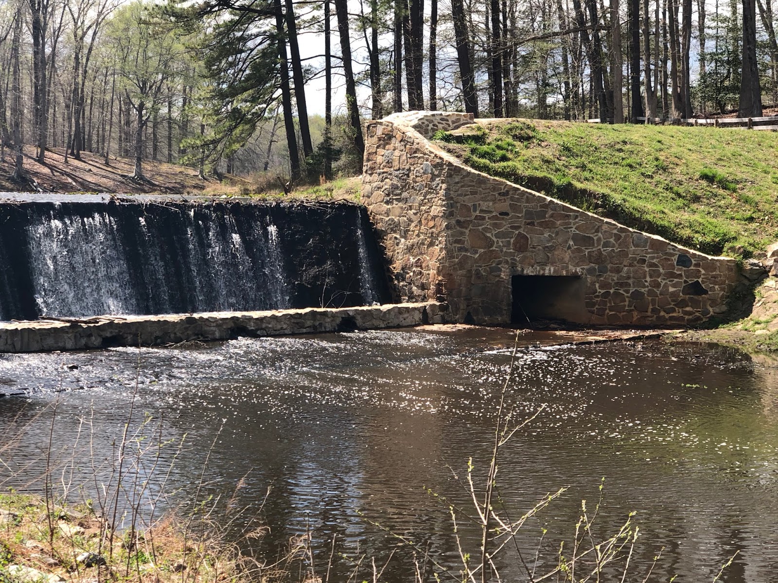
By making camp for a few days at Pocahontas State Park, we are almost there.  Plus, the park's location midway between Petersburg and Richmond, Virginia, gives us an opportunity to follow the final events of the Civil War.  More about that in forthcoming posts.  Today I'd like to share a little of the beauty we discovered at this park.


The wide roads leading to this campground were a bit of a relief.  Before I made our reservations last fall, I checked our truckers' atlas to make sure the road leading to the park was navigable by our big rig, the Dawntreader.  That research was inconclusive.  On the one hand, the route was not highlighted by yellow in the atlas, a sure sign that taking our big bus in that direction was not a good idea.  Yet, when I made our reservations on Reserve America, there were plenty of big-rig-friendly campsites in the park.  Clearly, previous rigs had navigated the questionable road into the campground safely so we decided we could, too.


And are we glad we did!  This park was perfect.  Big pull-through campsites with water and electric hook-ups, a dump station easily accessible and plenty of hiking trails to explore.


Our favorite was the  2.5-mile trail around the pretty-as-a-picture Beaver Lake.


We were almost sorry to leave, but Washington awaits and I'm looking forward to spending time with our family.

Saturday, March 24, 2018

Hillsborough River State Park


According to Florida's Division of Recreation and Parks, there are 175 state parks, trails and historic sites which encompass nearly 800,000 acres and 100 miles of sandy beaches in the Sunshine State, providing recreational opportunities for both residents and tourists.  Tim and I are two tourists who have grown to love these places.  (Click here for an interactive map of parks in the Florida State Parks system.)


When we first took to the road as full-time RVers back in January 2016, we thought our RV, the Dawntreader, was too long to fit in any state park.


However, we've since learned from friends like Doug and Chris that while our 45-foot length is on the long side, there are usually campsites that can accommodate us.  You just have to look carefully at the state park listings on ReserveAmerica.com when making a reservation.


This winter we've discovered that if you want to experience "the real Florida" as the park service's logo claims, there are no better places than these parks.  Off the beaten track, these protected areas are full of natural scenery with unbeatable beauty.


Hillsborough River State Park is a case in point.  The river that flows through it tumbles over rapids, then quiets to a calm where its current is hardly discernible.


It's perfect for kayakers and canoeists.


If a hike is more to your taste than a paddling adventure, pretty as a picture natural trails run parallel to the river's banks.


Bicycles may be rented at the park's cafe.


And for history buffs, Fort Foster, a reconstructed log stockade that during the Second Seminole War guarded a pivotal bridge over the river, sits in the northeast corner of the park.

Campsites have plenty of elbow room set apart as they are from one's neighbors.  Like most state park campgrounds, Hillsborough River State Park has water and electric hook-ups but no sewer connections.  However, there is a dump station where you can jettison waste on your way out of the park.


This morning Tim and I leave Florida to head north to our next Habitat for Humanity build in Macon, Georgia.  We'll miss its scenic parks, but hopefully we'll return next winter to sample a few more.  Until then, the Florida state parks of Hillsborough River, Rainbow Springs, Highlands Hammock, Mike Roess Gold Head Branch will brighten our memories.  Four down, 171 more to go!